
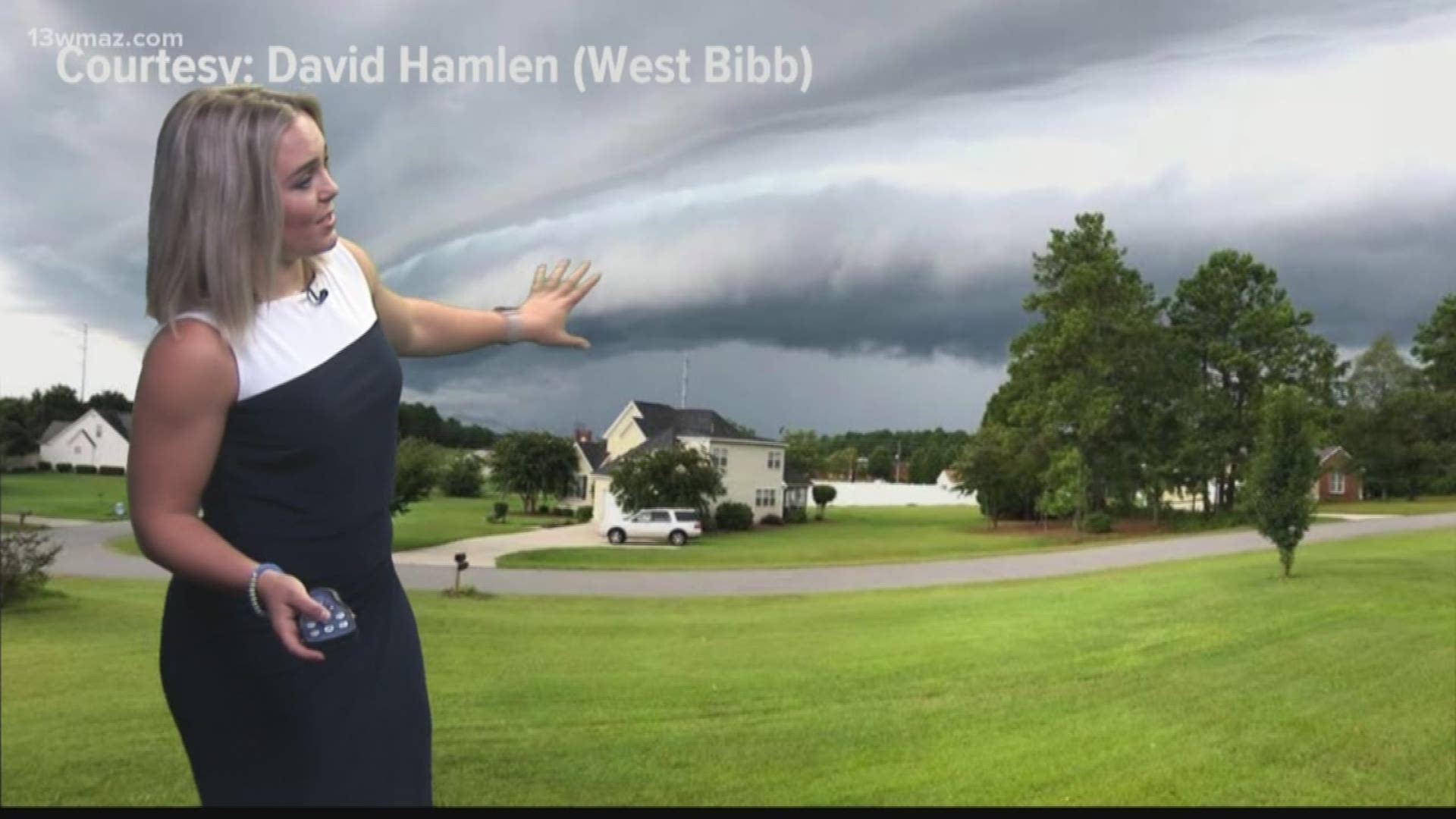
We've seen quite a few photos of shelf clouds this week -- they're dark and ominous, but you can't help but stare.
The National Weather Service defines them as a low, wedge-shaped cloud associated with a thunderstorm gust front or squall-line.
Here's how it works:
It all starts with a line of thunderstorms, also known as squall lines.
Squall lines produce very strong downdrafts of rain-chilled air. As that hits the ground, it spreads out horizontally, putting cooler air ahead of the storm.
This cooler air then runs into warmer air that hasn't been cooled by the rain. This is why we see warmer temperatures where you don't see storms roll through.

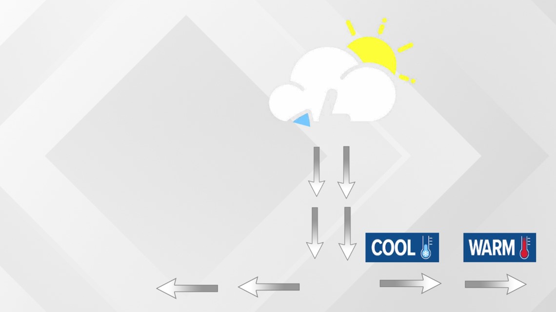
Once the cool air runs into the warmer air ahead of it, the warm air rises. Cooler air is more dense, and as it slides under the less dense warm air, it rises.
As the air rises, it cools, condensing to form clouds. Since shelf clouds are associated with squall lines, that's why the clouds look like they're spread out along the horizon.

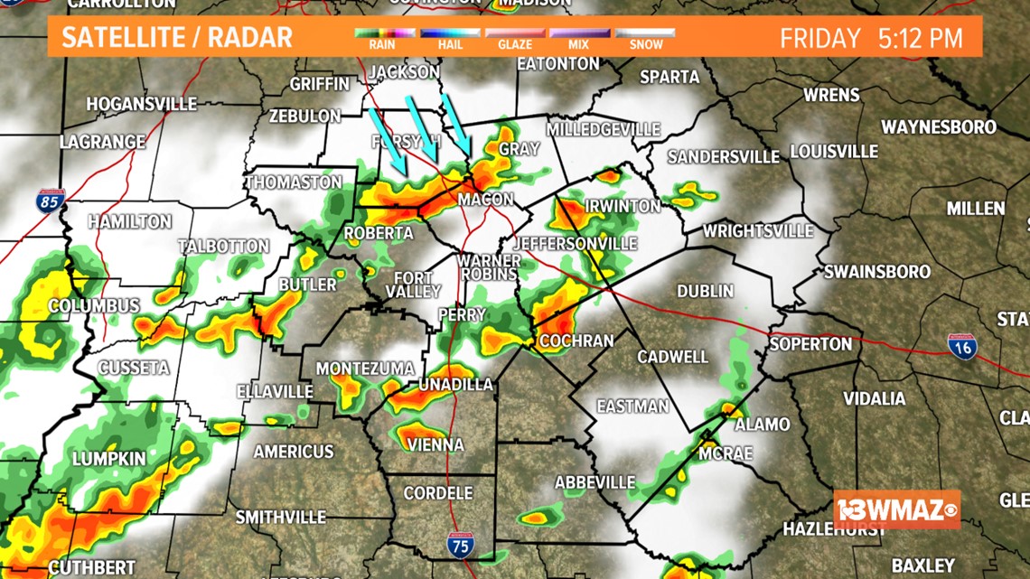
The line signified by the blue arrows is one of the squall lines that rolled through Bibb County Friday night, producing an impressive shelf cloud.
David Hamlen snapped this shelf cloud in west Bibb County.

We love to see your photos! Be sure to send them in to the 13WMAZ Facebook page!