

MACON, Ga. — Tropical Storm Nicole is strengthening in the Atlantic Ocean with its sights set on the Florida east coast. Nicole now has sustained winds of 60 mph and is forecast to become a Category 1 hurricane before landfall.
Hurricane warnings are in effect for parts of Florida with tropical storm watches stretching into Savannah and extreme southeastern Georgia.

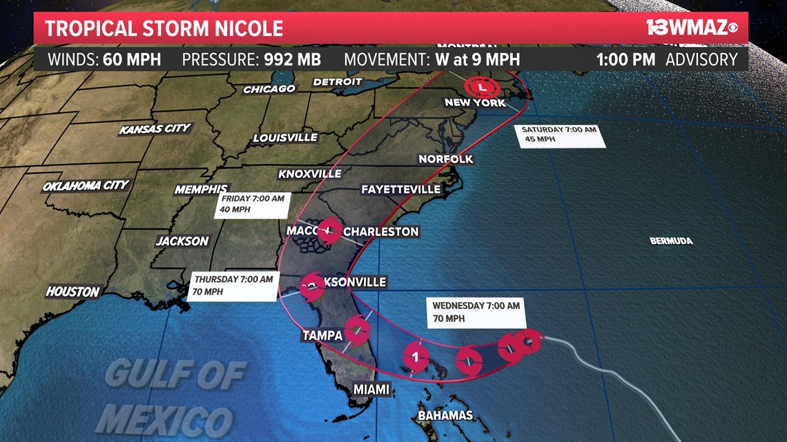
Central Georgia is in the forecast cone, and we expect impacts to start Thursday evening.
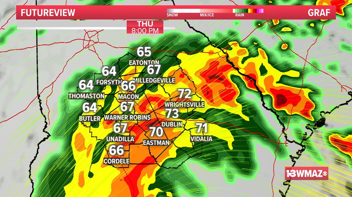
Our biggest impact will definitely be heavy rain. The heavy rain bands will roll Thursday night into Friday morning. We could one to two inches area-wide, with localized larger amounts possible.

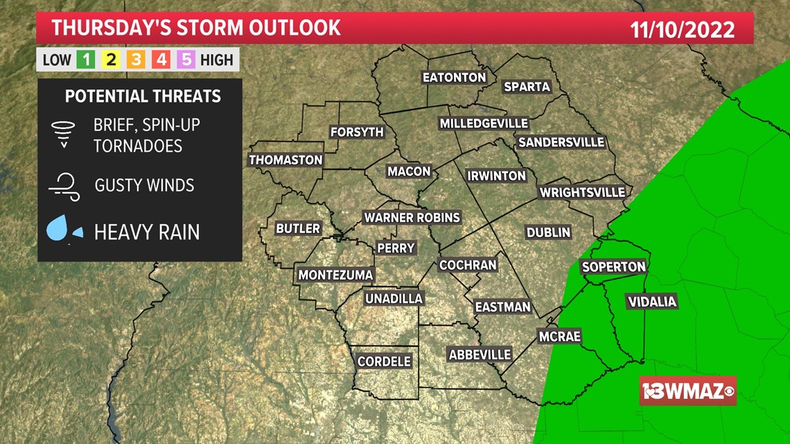
Now, if the models keep trending west like they have been on Tuesday, that may put some Central Georgia counties on the "dirty side" of the storm. That right side of a tropical system may contain gusty to damaging winds and brief, spin-up tornadoes.
Because of that, the Storm Prediction Center has placed extreme southeastern Central Georgia in a level 1 risk for severe weather, mainly for the tornado threat.

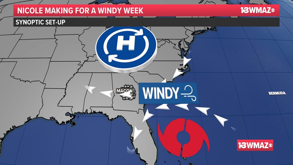
Everyone in Central Georgia will feel the wind though. That's all thanks to the big high pressure system to our north and Nicole to our south. As those two systems come closer together, the area in between the two will experience gusty winds. So, we could see wind gusts up to 45 mph through Friday.

All of the impacts from Nicole should be gone by late Friday or early Saturday as a big cold front pushes the storm out to sea. As always, keep up with 13WMAZ on air and online for more tropics updates.
WHAT OTHERS ARE READING: