

MACON, Ga. — Central Georgia is experiencing the threat for severe storms come late Sunday morning through the evening. Here are more details on the timing and threats from the storms:
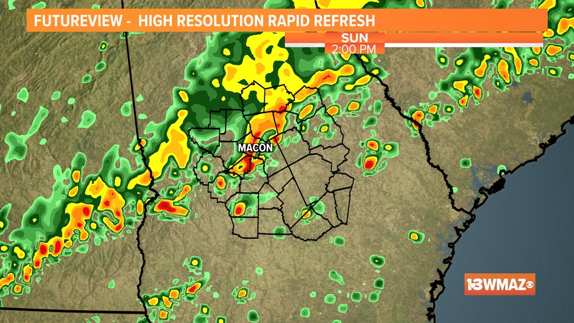
Sunday Morning
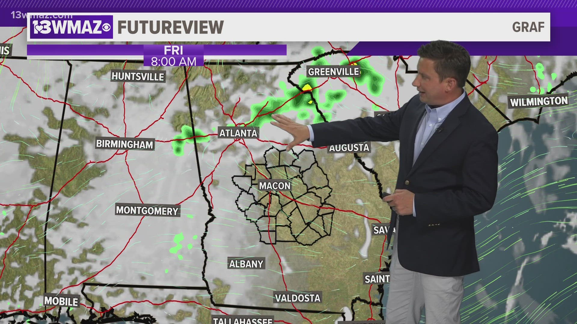
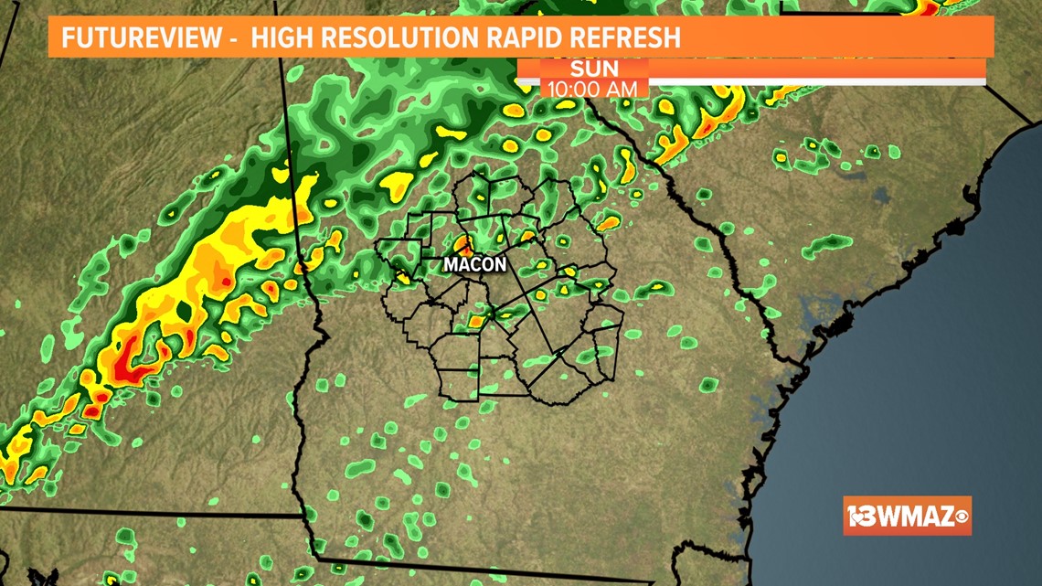
A broken line of showers and storms will enter from the northwest bringing with it mainly the threat for heavy rain and gusty wind. Thankfully our overcast skies for the morning will help limit the severe threat. The afternoon brings with it a different story.

Sunday Afternoon
Come afternoon, breaks in the clouds are possible. This will help fuel our atmosphere to allow for redevelopment of storms along our cold front.
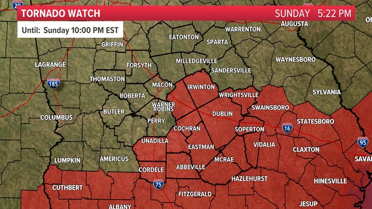
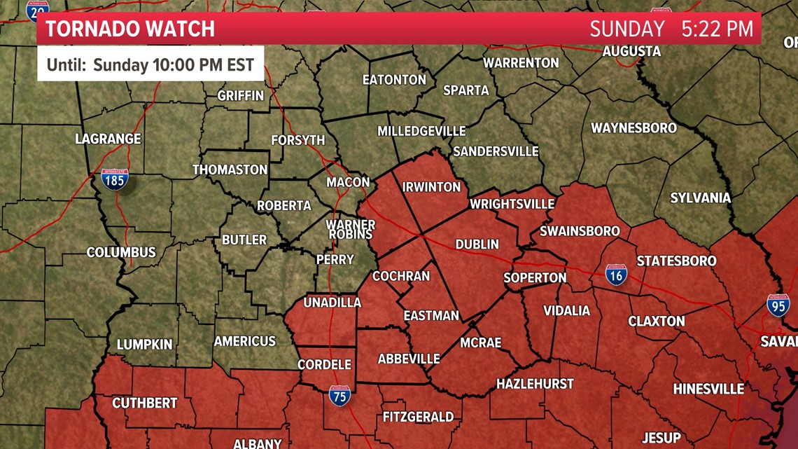
The afternoon into the evening looks to carry the best chance for severe weather.

Sunday Evening
Storms, some possibly severe, will be pushing east of 75. The main threat will continue to be damaging wind gusts upwards of 60 mph and heavy rain, but a brief tornado can't be ruled out. Flash flooding will also need to be monitored due to the slow movement of the front.

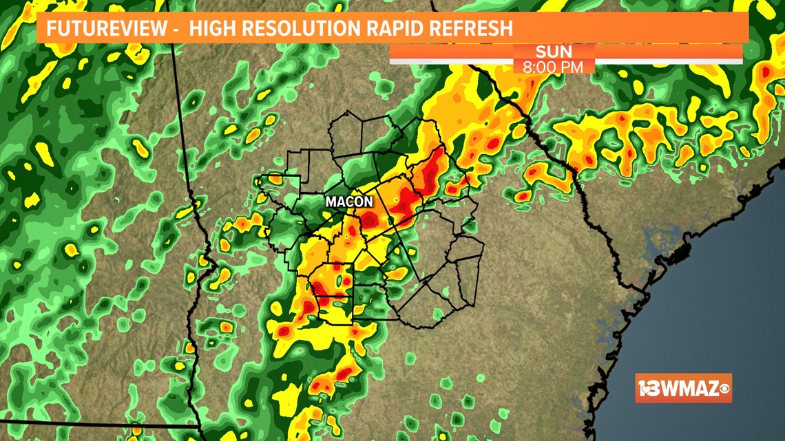
By around 9 p.m., we can bring the severe threat to an end. A few trailing showers will be possible for the late night.
Temperatures will be much different behind this front for the first week of 2022.
Make sure to have the 13WMAZ app downloaded to receive the latest weather alerts.
STAY ALERT | Download our FREE app now to receive breaking news and weather alerts. You can find the app on the Apple Store and Google Play.