
(UPDATE: 5:40 p.m. Friday) As we move into the weekend and the possible local effects of Hurricane Delta, the latest updates will be located in our main weather forecast story. You can access it here.
What is the storm doing now? :
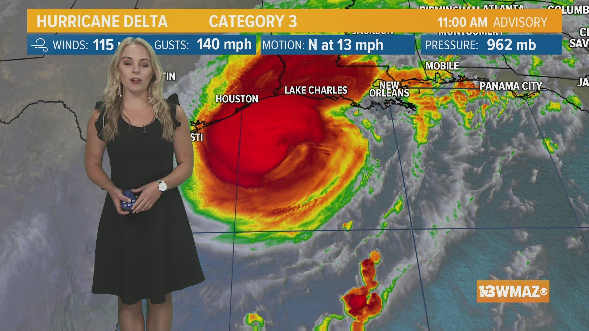
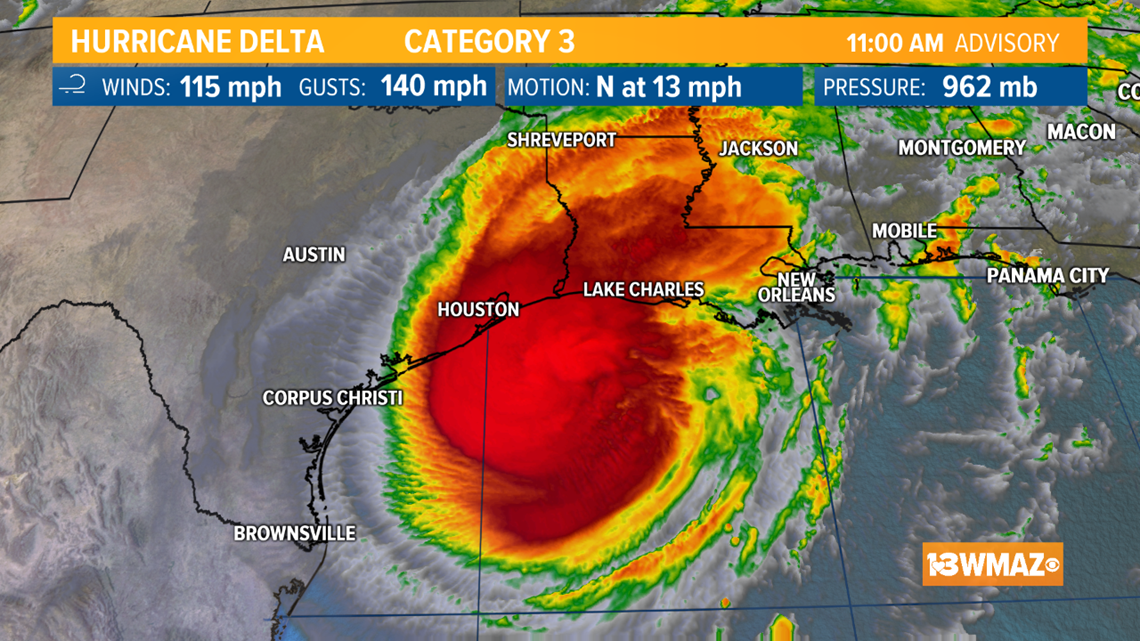
As of the latest advisory, Delta has slightly weakened as the outer rain bands start to interact with land along the Gulf. The storm is now a Category 3 hurricane with winds of 115 mph.

Where Could Delta Go? :
Delta will make landfall Friday night along the Louisiana coast, and rapidly weaken as it moves inland. The storm will be a tropical depression as it passes by to our north. Not much has changed to the forecast track since earlier this morning.

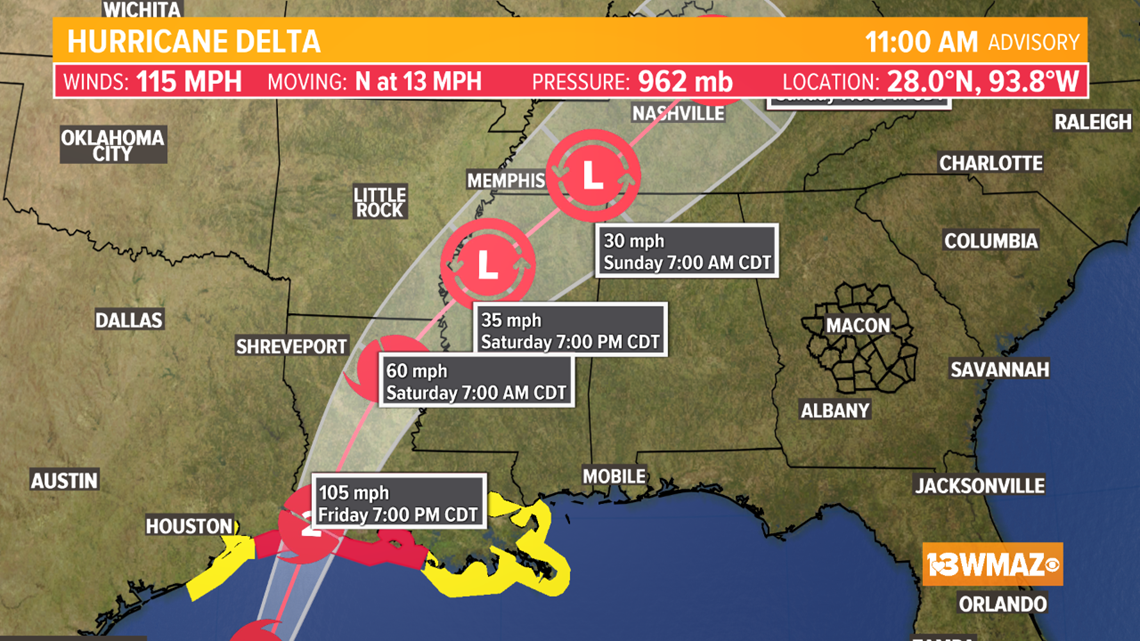
Delta will make a landfall tonight potentially as a Category 2 storm, becoming the tenth storm to make landfall in the 2020 season.

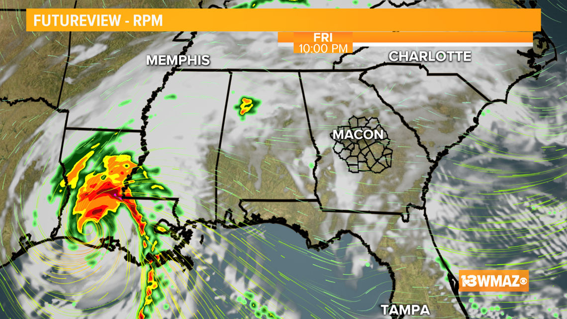
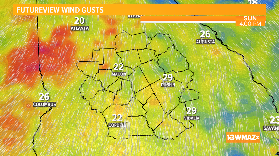
As Delta moves inland, it will weaken, but also increase our rain chances over the weekend. Our breeze will pick up starting Friday night with gusts between 15-25 mph and isolated gusts of 30 mph possible.


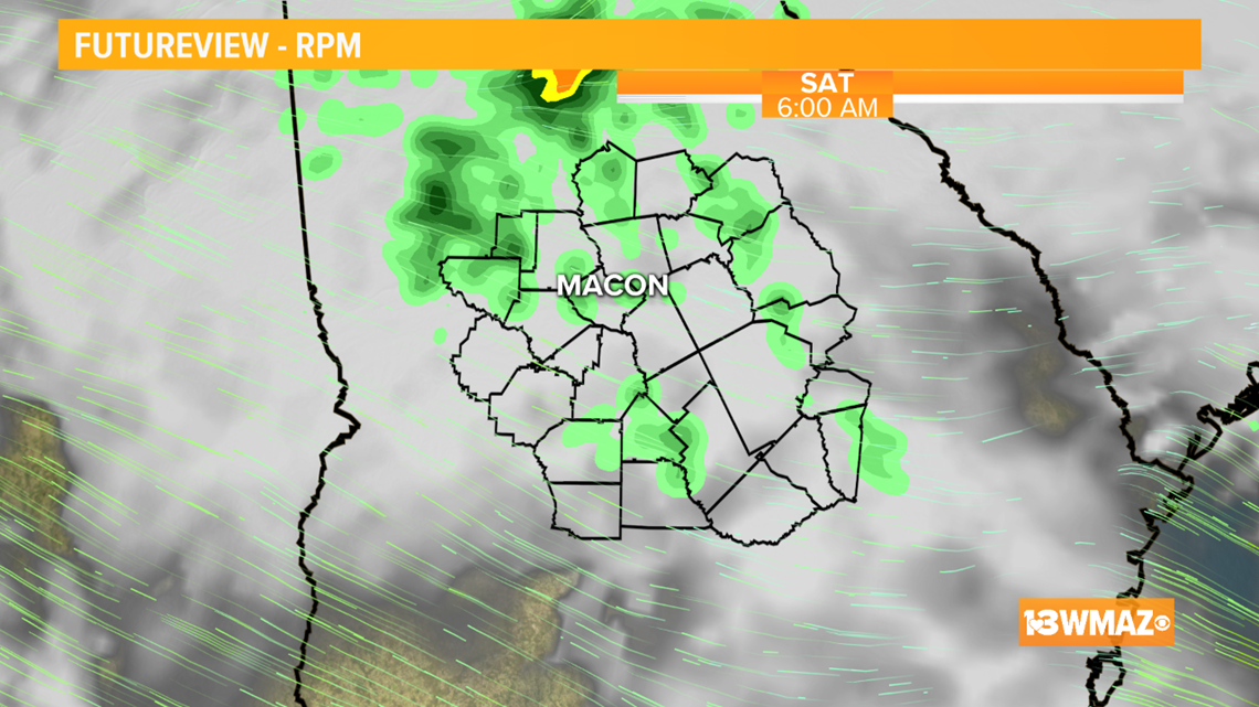
A few storms will be possible Saturday afternoon and evening. While we have no organized severe threat, one or two could be on the strong side with gusty wind and heavy downpours.

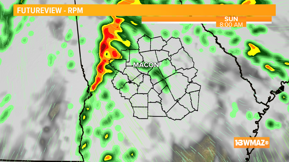
Come Sunday morning, the last trailing line of storms from a weakening Delta will be pushing close to our area. The latest models show it does have potential to hold together. If the line holds together, we may have to watch for a few strong storms for both the morning and afternoon as it pushes through and takes advantage of daytime heating.

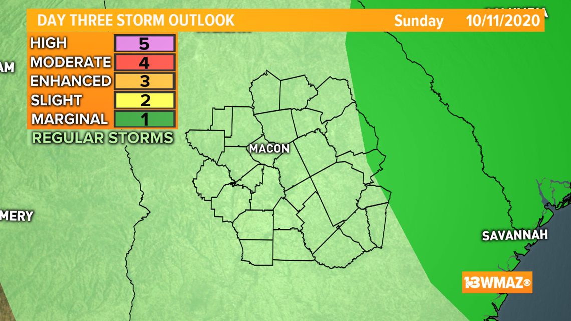
For now, a marginal (1 of 5) threat just clips our eastern most counties. While a strong storm with gusty wind can't be ruled out late Sunday morning into the afternoon, the larger and more organized threat lies in the Carolinas.
What Are The Potential Impacts?:
We will start with our wind threat. Keep in mind, all of our threats are subject to change as we get closer to the weekend.
By Friday evening, wind will start to pick up. Through the weekend, wind gusts between 20-25 mph with isolated gusts upwards of 30 mph are possible.

Looking towards the weekend, on and off rain with an isolated storm or two will be possible throughout the day Saturday starting in the morning.

By Sunday evening, the last swath of rain from Delta will be pushing through our area, clearing from West to East.


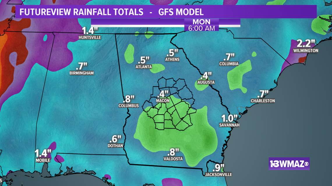
Rainfall amounts continue to look small for our area. We could see upwards of an inch with locally heavy amounts under any heavier downpours.

Timing:
Right now we could see pockets of light rain in parts of the state come Friday night.
The main time frame we will be watching for our greatest impacts will be Saturday afternoon into Sunday afternoon.
Bottom Line:
Tropical Storm force conditions as of now are not likely across the area, however, we still could see gusty wind and maybe an isolated severe storm Sunday.