
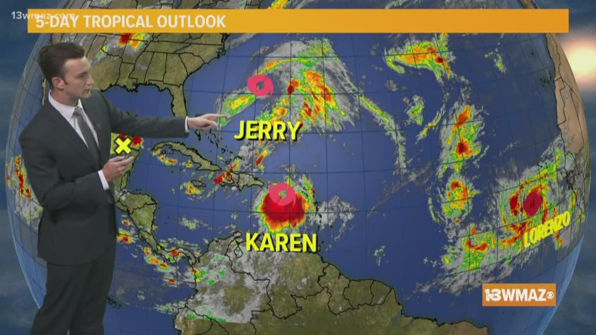
After Imelda brought prolific rain to parts of Texas last week, the tropics remain quite active with 3 named storms to keep tabs on in the Atlantic over the coming days.
In addition to the named storms, the National Hurricane Center is also monitoring an area of broad low pressure in the Gulf. For now this system is only given a 20 percent chance of development in to a tropical depression or a tropical storm over the next 5 days.
The three named storms are Jerry, Karen, and Lorenzo. None of these storms pose a threat to the United States at the moment, but Karen in particular will bear watching.
So let's meet the storms...
Tropical Storm Jerry:
Jerry fortunately poses no threat to the United States, but could move very close to the island of Bermuda as this re-curves in to the Atlantic Ocean.
Jerry is expected to weaken in to a tropical depression by Thursday morning.

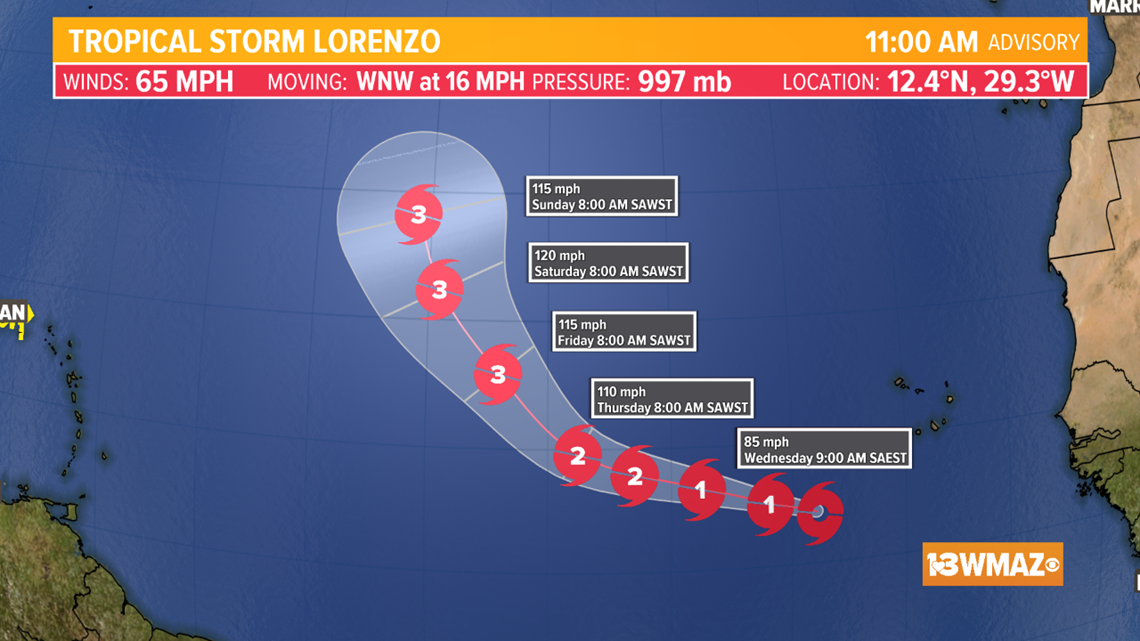
Tropical Storm Lorenzo:
Lorenzo is a high end tropical storm, and is expected to reach hurricane status over the coming days. In fact, Lorenzo is forecast to reach major hurricane status by the end of the week.
Despite the strengthening, the good news with Lorenzo is that this system is way out in the Atlantic, and will not be a threat to any land in the next week. Lorenzo is likely a storm that stays in the Atlantic based on it's northerly forecast track. Nonetheless, we'll keep an eye on Lorenzo as it strengthens this week.

Tropical Storm Karen:
Of the three named storms, Karen is currently the system that needs to be watched most closely.
In the short term, Karen is expected to track over Puerto Rico bringing locally heavy rain and gusty winds. A Tropical Storm Warning has been issued for the island of Puerto Rico.
After passing the island, Karen is expected to continue generally northward through Thursday as a tropical storm.
However, by Friday and the weekend a strong ridge of high pressure is expected to develop over the northern Atlantic. This will act as a blocking mechanism for the system, and may force Karen to make a westerly turn.
This turn could take Karen towards the Bahamas, the southeast coast, or even the Gulf of Mexico in the long term, but the exact track remains to be seen.
Karen is not an immanent threat to any part of the US, but it is a system we'll be watching closely over the coming days.

We'll be sure to keep you posted with the latest on the tropics. Be sure to download the 13 WMAZ App to have access to the latest on tropics and our local forecast.
STAY ALERT | Download our FREE app now to receive weather alerts. You can find the app on iTunes and Google Play.