
MACON, Ga. — Update, April 4 at 11 a.m.:
Updates from the Crisp County Sheriff's Office, they say some roads are still closed and crews are working to restore damaged areas.
Sheriff Billy Hancock says North Cedar Creek area remains closed, with traffic being controlled by the Crisp County Sheriff’s Office. Power crews are actively engaged in restoration efforts, which may lead to increased traffic as responders and workers continue debris clearance.
EMA officials ask residents in the area to be mindful of heavy equipment, including bucket trucks and dump trucks, as well as other large machinery required for operations in the area.
-------------------------
Original:
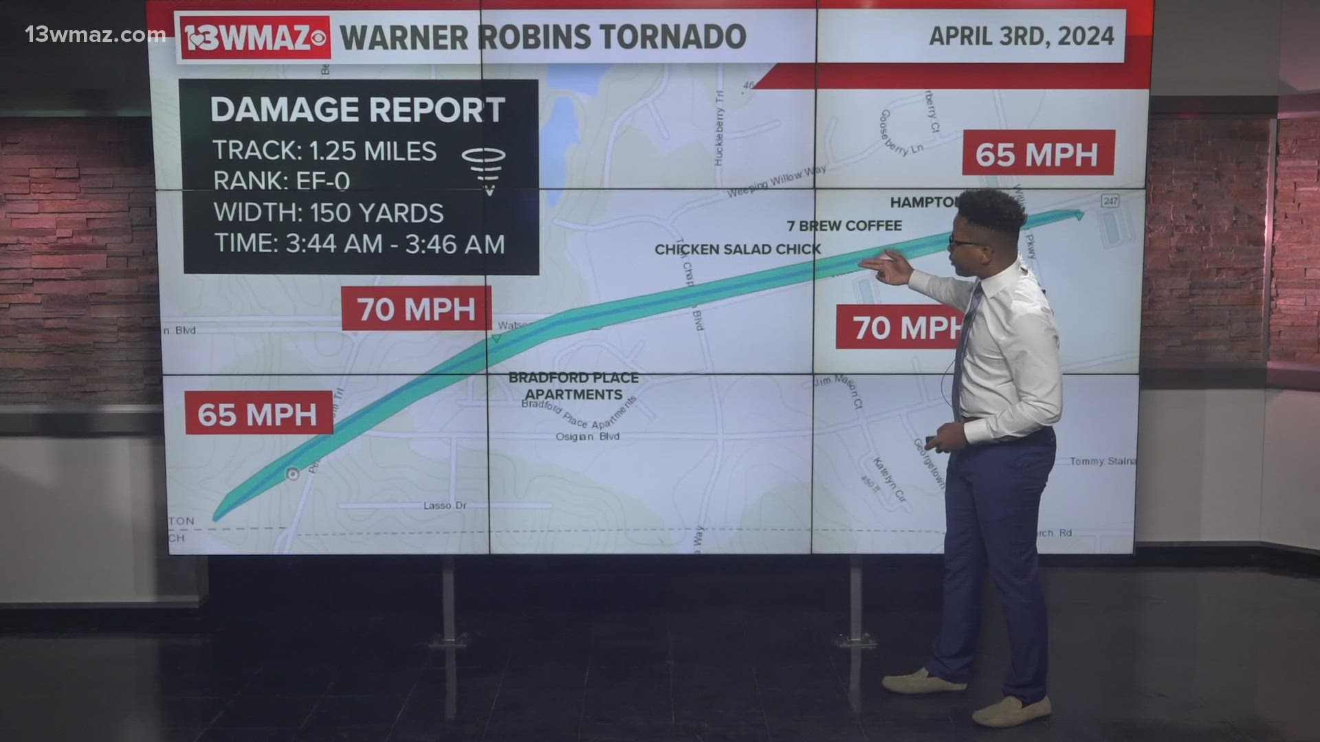
Severe storms swept through much of Central Georgia early Wednesday morning.
The Storm Prediction Center placed much of Central Georgia in a Level 3 out of 5 risk for severe weather, which includes anything from damaging winds to flooding risk and the possibility of a few tornado spin-ups.
We are actively trying to find out more information from the affected area's emergency management directors, and we're doing what we can to find out the latest on road closures and power outages.
Sheriff Billy Hancock provides updates:
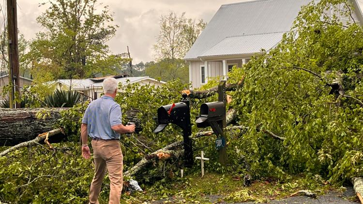
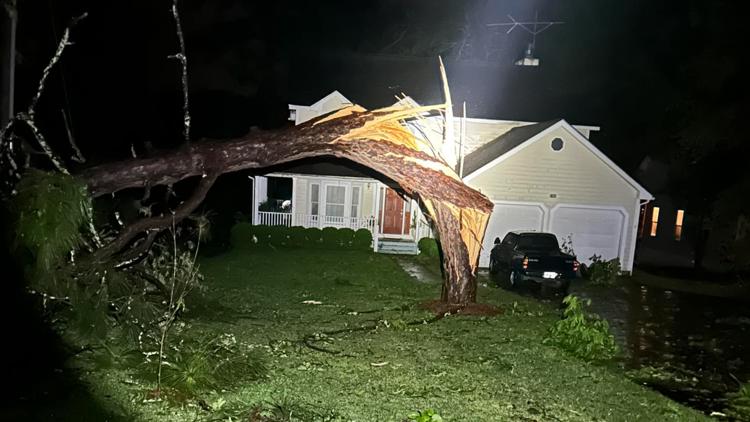
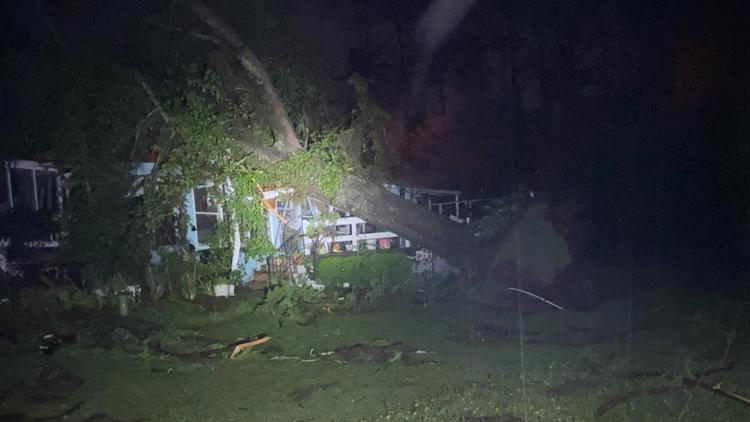
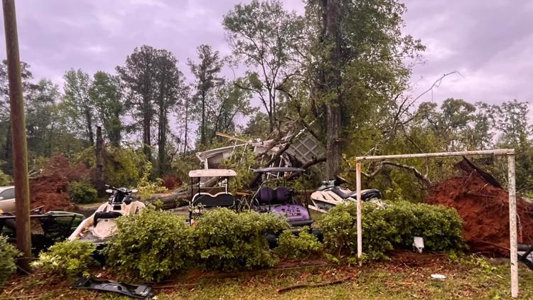
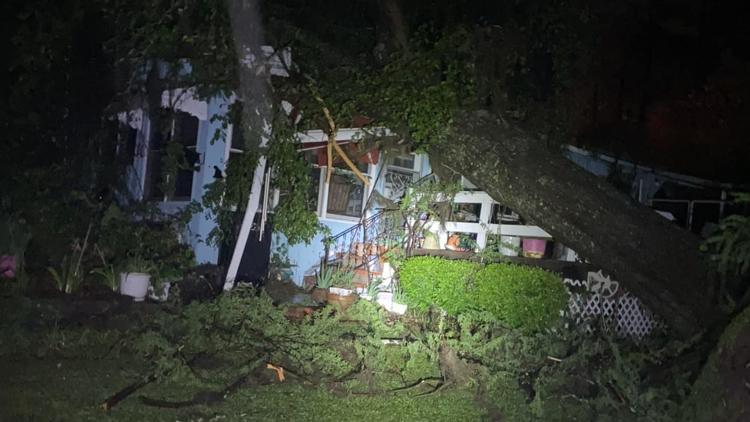
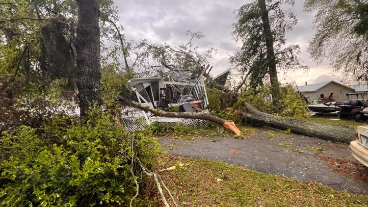
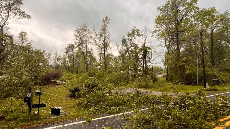
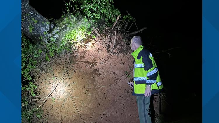
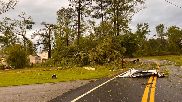
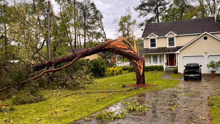
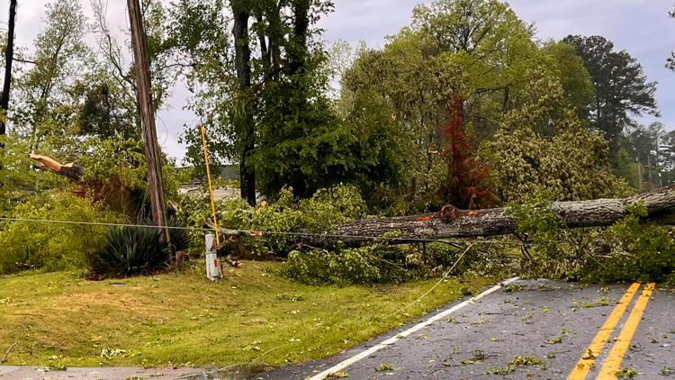
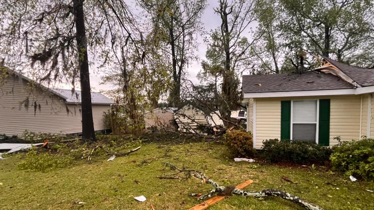
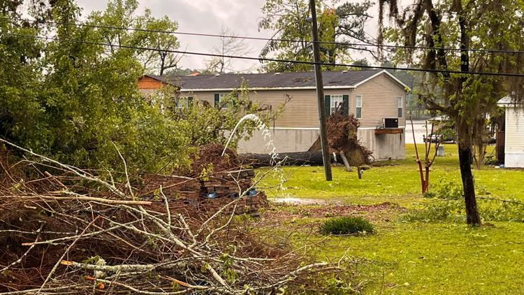
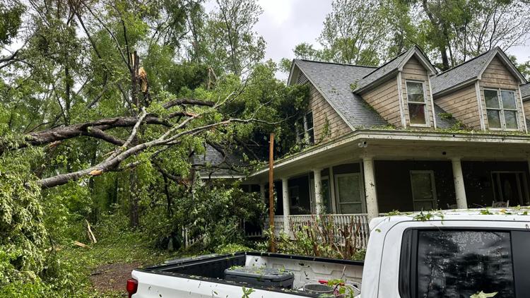
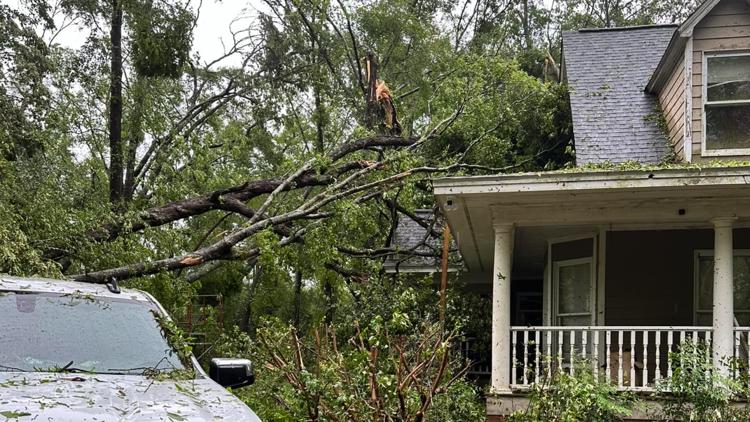
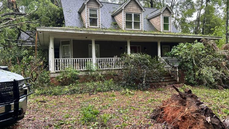
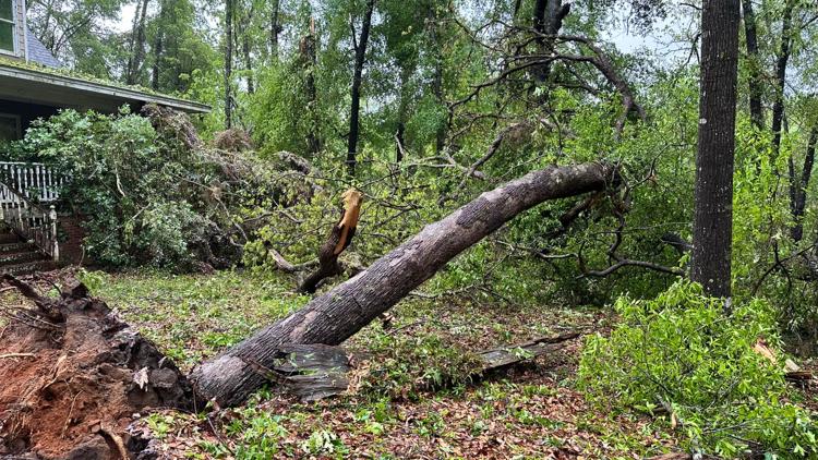
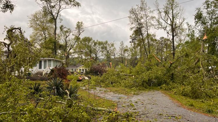
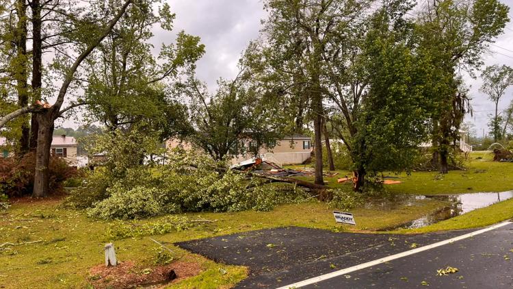
The National Weather Service confirmed taht Crisp County was hit by an EF-1 torando with max winds of 100 mph. Hancock said on Facebook that the tornado's path was roughly 6.3 miles and the sheriff's office said the storm impacted 36 homes. They also said 19 houses suffered "major damage."
Here is some of the information he shared:
If you are called by a resident for repairs related to property you must check in at the Lake Blackshear Baptist Church. There are portions of the road that are still not accessible and closed by Law Enforcement.
Reminder:
There are multiple downed trees and downed power lines. If your structure is not damaged please stay inside. If your structure is damaged and you need to be removed for safety or you need emergency services please dial 911!
Here's more of what we know right now as information flows into the 13WMAZ Newsroom.
Affected areas: A tornado warning was issued in Telfair and Wheeler counties at around 6:30 a.m. A tornado warning was issued for Houston, Wilkinson, Laurens and Twiggs Counties at around 3 a.m.
But so far, no major damage has been reported any of these areas. Another tornado warning was issued in Crisp, Dooly and Sumter counties just before 4:50 a.m. 13WMAZ is checking into damage reports in both areas.
Damage reports;
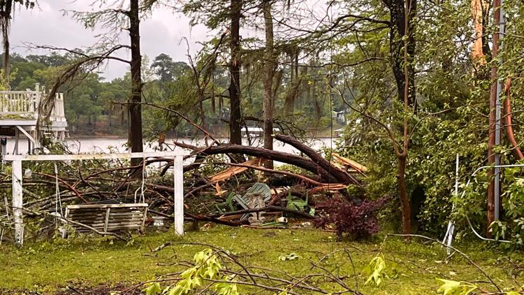
Crisp County PIO Haley Wade said "There are multiple structures with major and minor damage in the Scenic Route and Cedar Creek area. There are multiple downed trees, downed power lines, the possibility of gas leaks. If your structure is not damaged please stay inside. If your structure is damaged and you need to be removed for safety or you need emergency services please dial 911. Authorities are not allowing any additional traffic in the area. Those who have family or live in the area must check in at the Command Center that is set up at Lake Blackshear Baptist Church.
Crisp County is now under a Declared State of Emergency for the Scenic Route and Cedar Creek area of Lake Blackshear. A local state of emergency declaration serves several important purposes. First, it triggers emergency powers and authorities vested under a local emergency ordinance. Second, it activates local emergency operations plans and mutual assistance compacts, and authorizes providing mutual aid assistance. Third, it is the vehicle by which local emergency measures, such as evacuations and curfews, are legally imposed (GS 166A-19.31). Finally, it is usually a requirement for receiving state and federal reimbursement for emergency-related expenses. We DO NOT have a curfew or evacuation orders at this time."
In Houston County, EMA Director Chris Stoner says they have some limbs and debris down around 41 in Centerville that crews are clearing, but overall it’s the same they see with most strong thunderstorms. They are on standby to see if any reports come in as the sun comes up, but so far damage there seems minor.
Power outages: Flint EMC is reporting under 200 are without power in Houston County, specifically in the Watson Boulevard area. This is down from the nearly 1,300 reported earlier this morning. As of 3:30 p.m., the number of outages in Houston County are down dramatically. It is now 25 outages.
The 13WMAZ Weather Team is tracking weather as it moves through the region.
IMAGES: Storm damage in Crisp County


PHOTOS | Send us your severe weather pictures on Facebook and by texting 478-752-1309.
STAY ALERT | Download our FREE app now to receive breaking news and weather alerts. You can find the app on the Apple Store and Google Play.